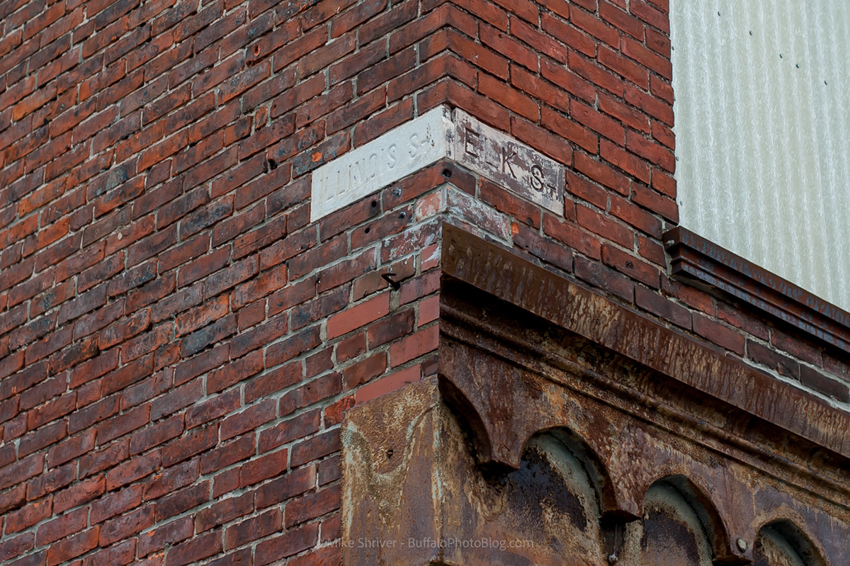
Illinois & South Park in Historic Cobblestone District (Formerly named Elk, which was an extension of current day Elk Street)
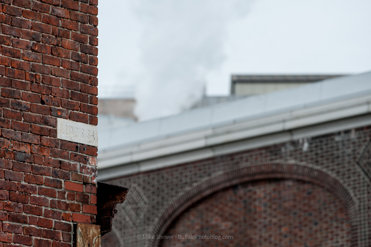
Another view from Illinois Street
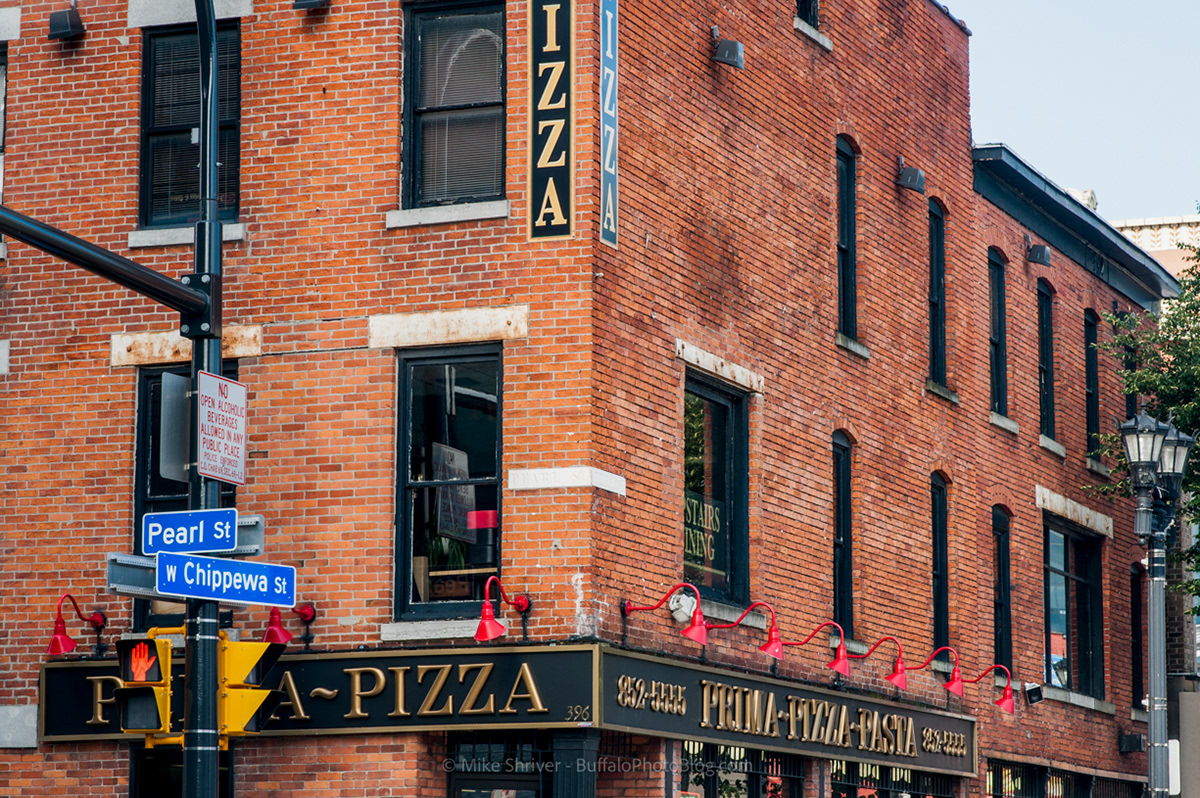
Tough to make out, the image above reads Pearl St and Chippewa
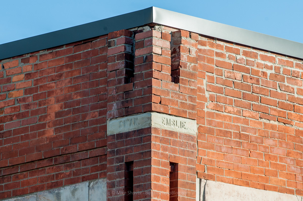
Swan & Emslie in Larkinville
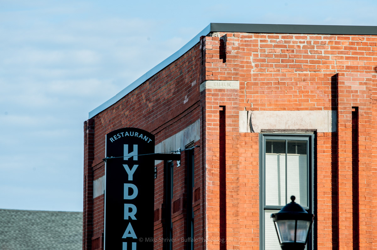
Another view of Swan & Emslie, near the top of the second floor on current day Hydraulic Hearth Restaurant
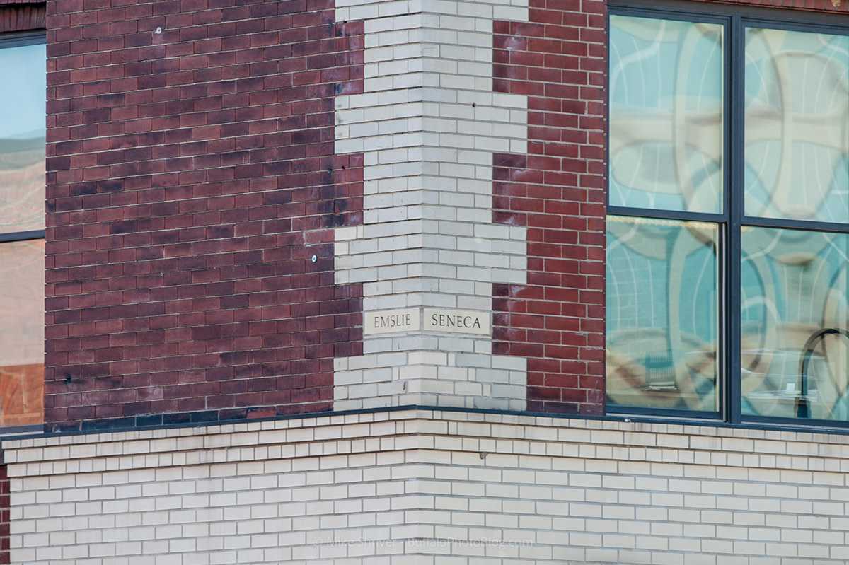
Emslie & Seneca, right across the street from the previous image in Larkinville
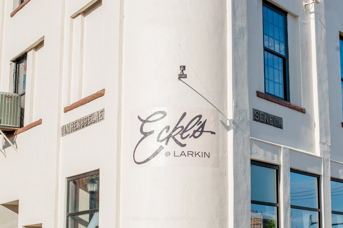
Van Rensselaer Street and Seneca in Larkinville
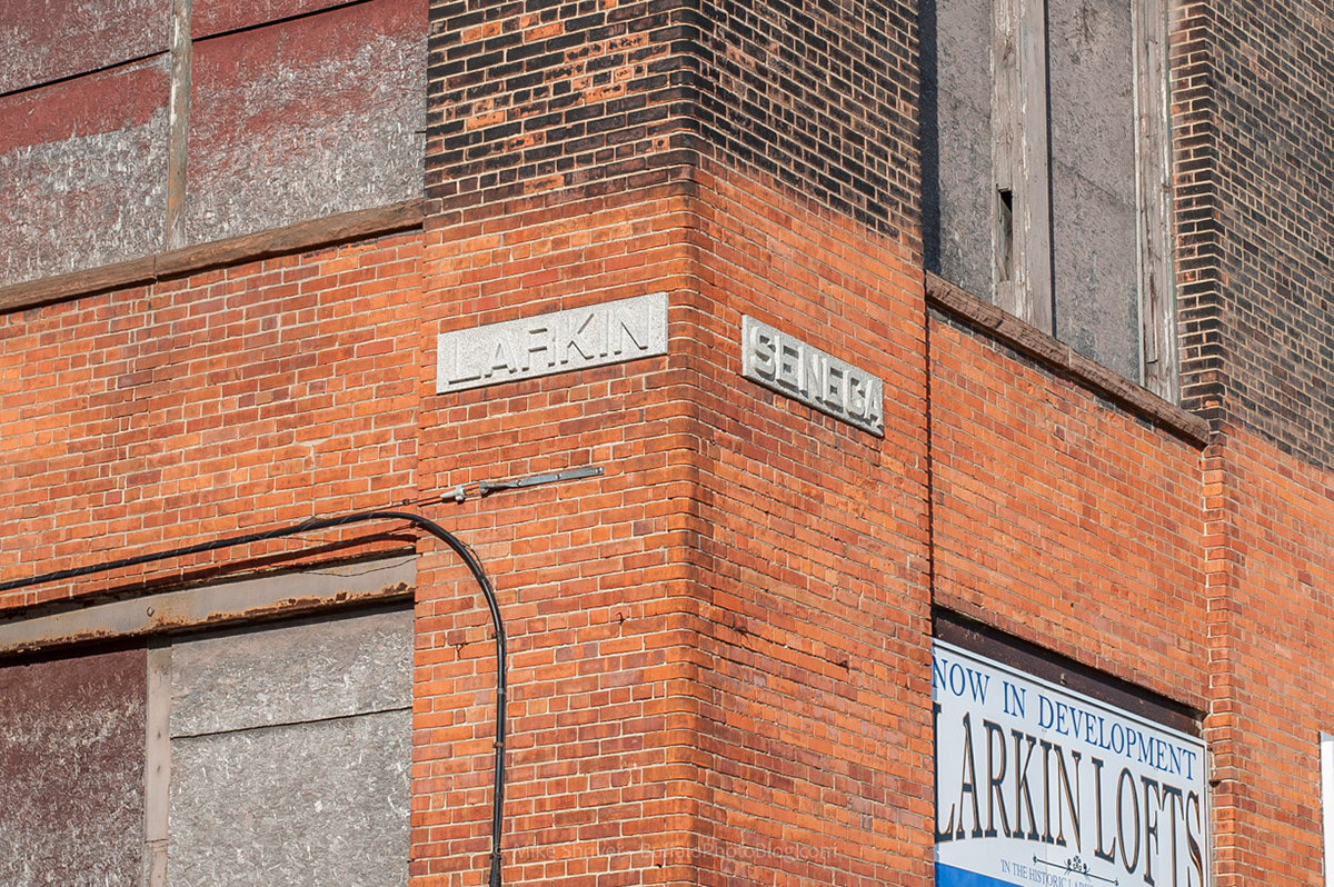
Larkin and Seneca Streets, Larkinville
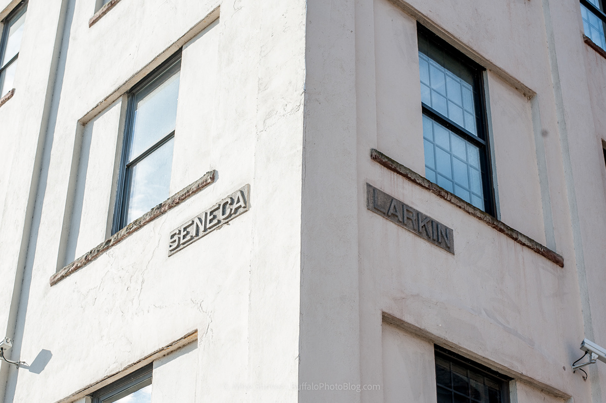
Seneca and Larkin, across the street from the previous image, in Larkinville
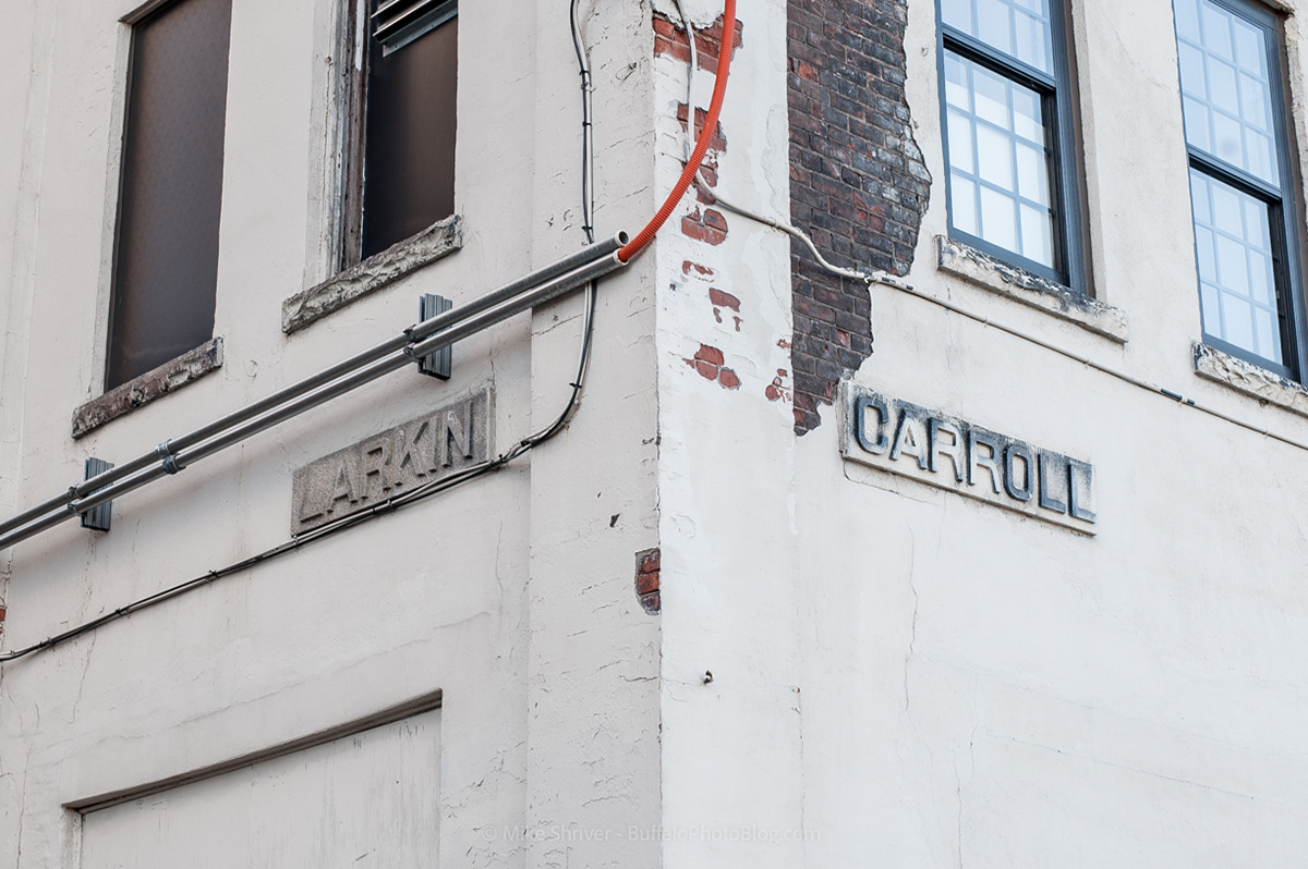
Larkin and Carroll, Larkinville. Carroll is no longer extended to this part of town, but when the building was erected it would have ran through the current parking lot residing there today.
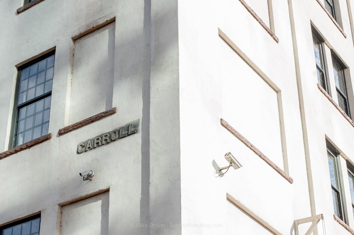
Carroll Street, no longer extended this far, in Larkinville. This is the final of 7 corner building street signs found in Larkinville, the most of any other part of Buffalo.
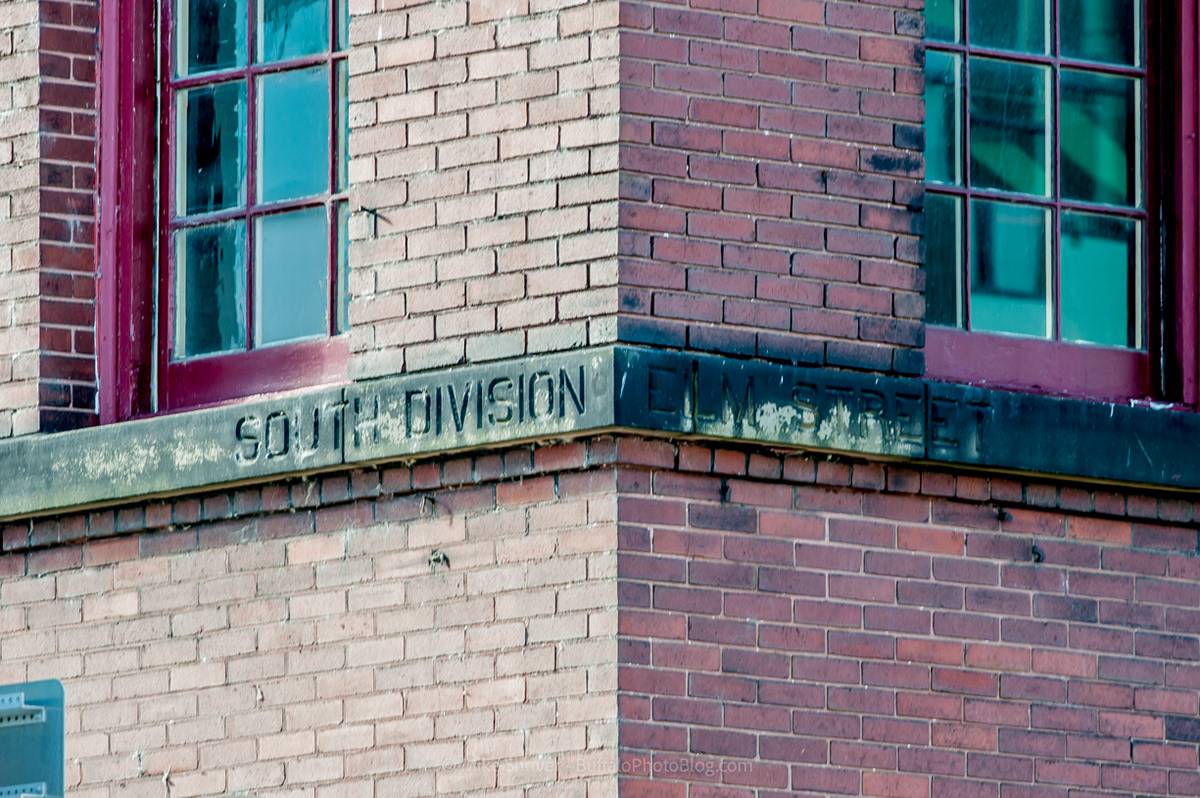
South Division and Elm Street. I almost missed this one, as it's hardly visible in Google Maps. The patina is strong with this corner building street sign!
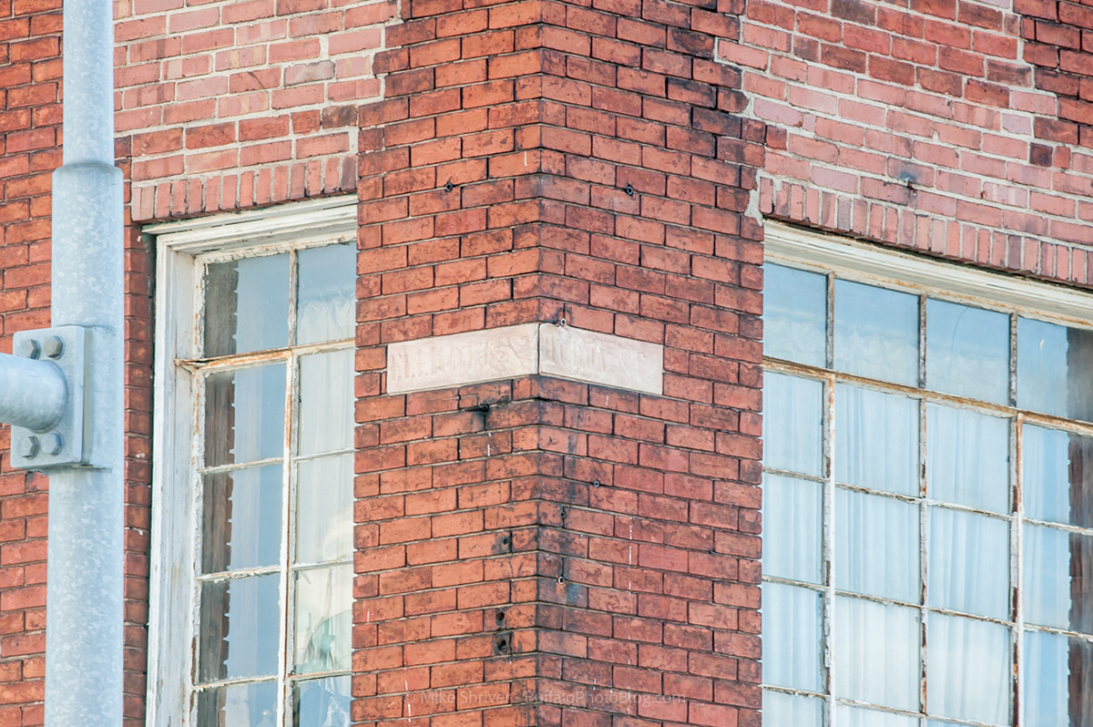
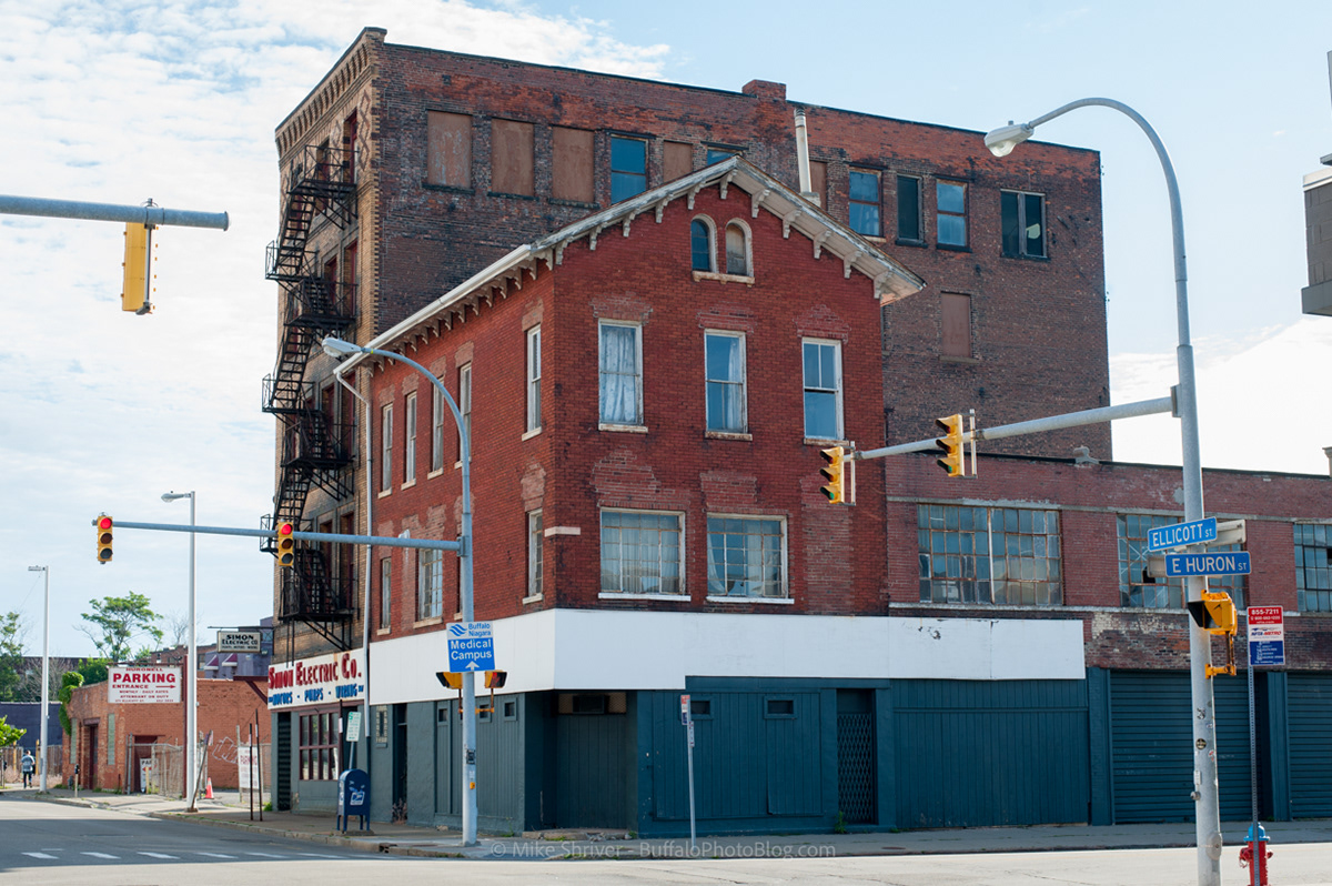
Ellicott and Huron Street - barely visible due to the age of the building, a full scale image is below. The building shows it's age and is directly across the street from Big Ditch.
Full scale of the previous image. Ellicott and Huron.
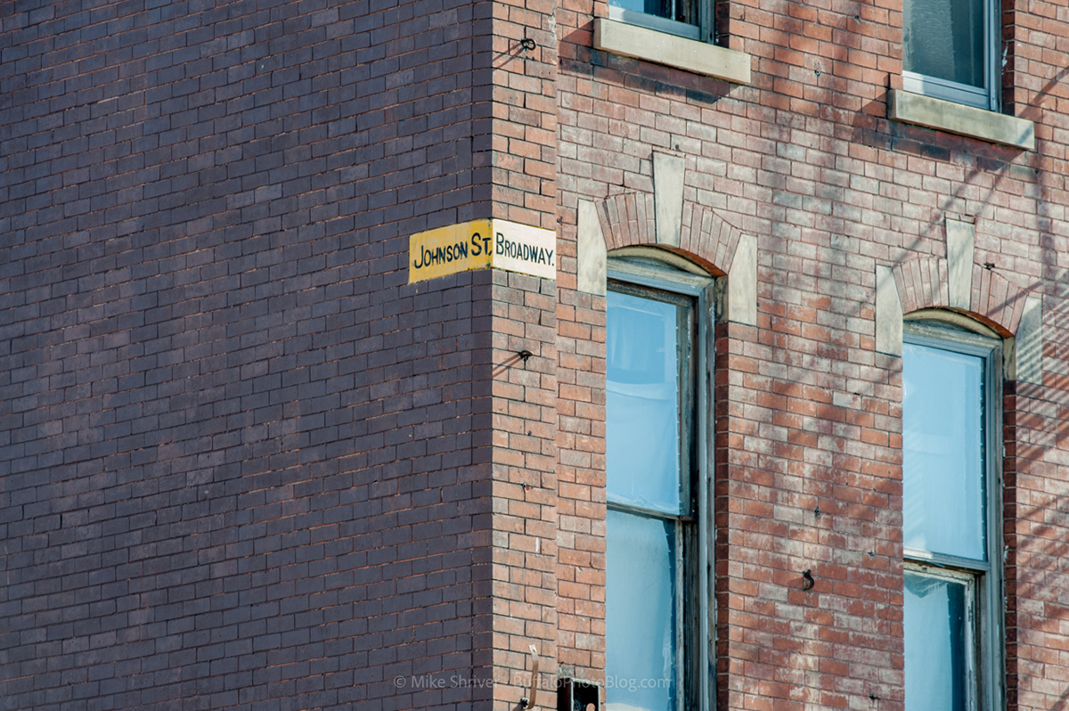
Johnson Street and Broadway, Buffalo's East Side. One of three I found along Broadway. I'd imagine there had to of been hundreds alone along this stretch during the early 1900s.
Full scale of the previous image. Imagine if our city still looked like this?
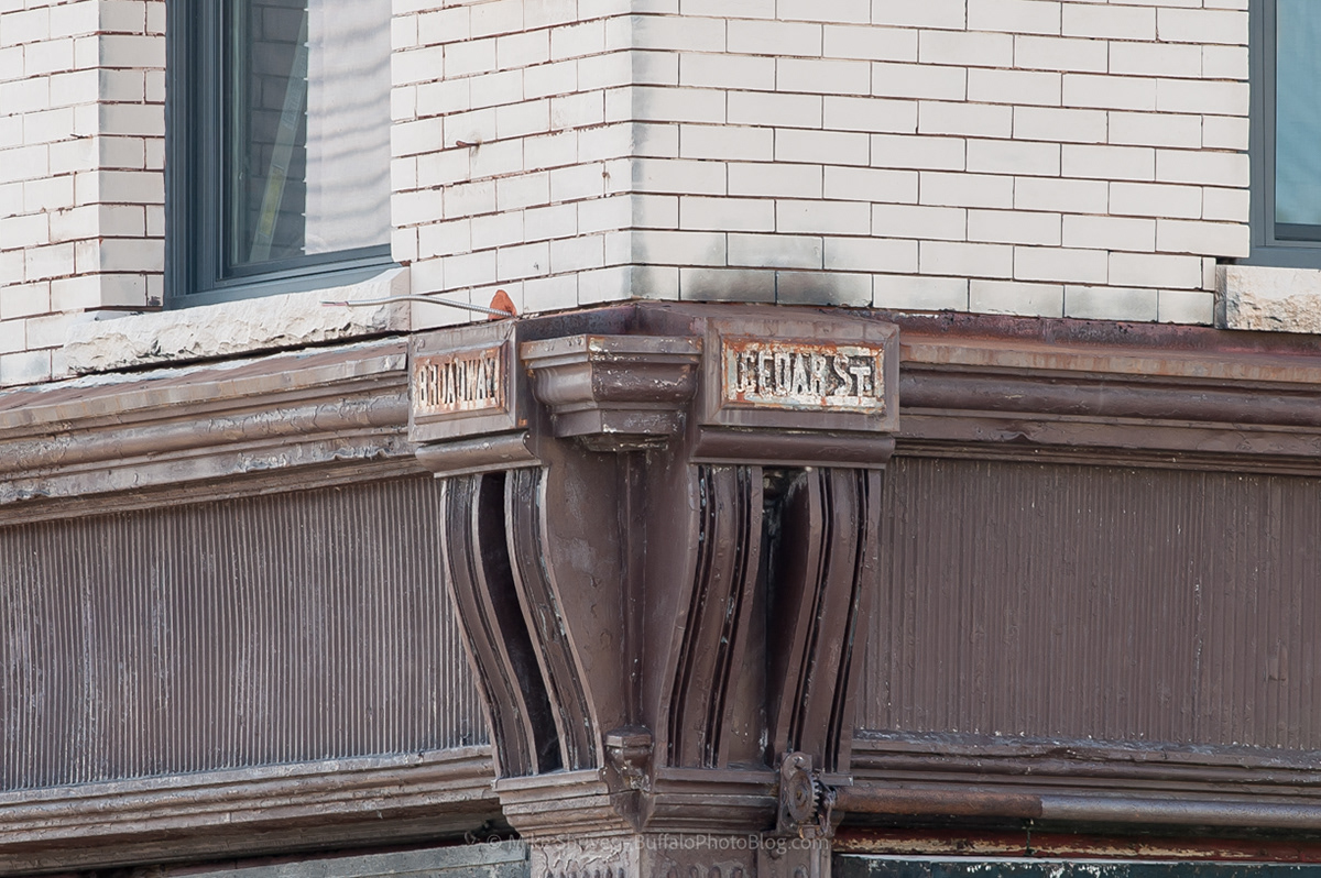
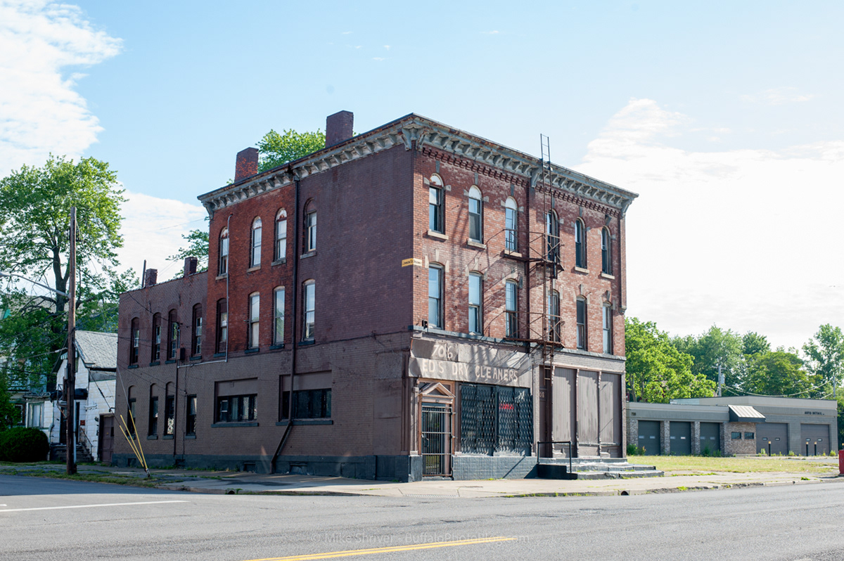
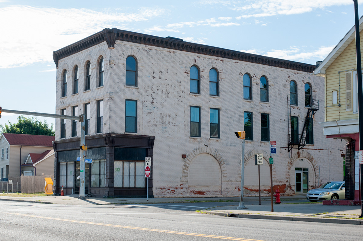
Broadway and Cedar Street, another one along Buffalo's East Side.
Full scale of the image above, Buffalo's East Side.
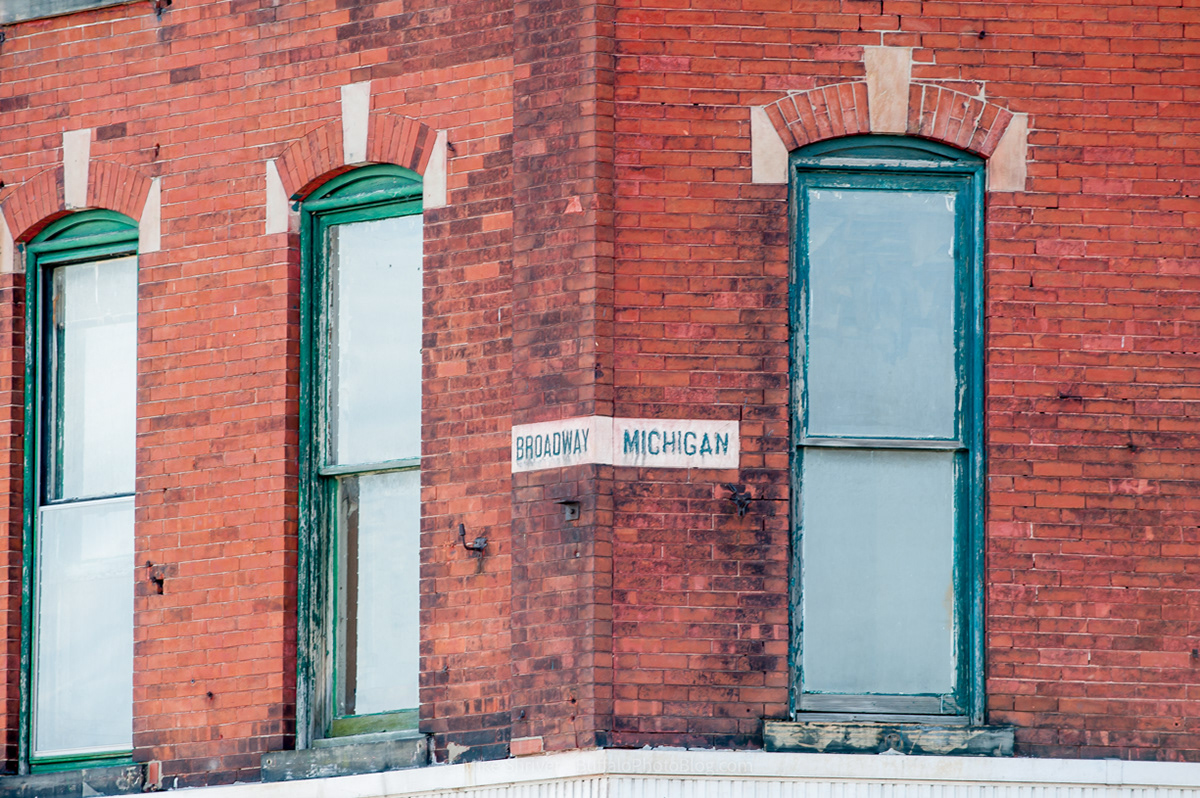
Third corner street sign I found on Broadway, corner of Michigan Avenue.
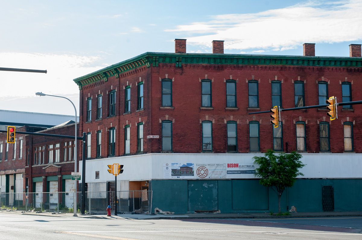
Full scale of previous image. Being renovated with plans of apartments and retail. Located along the Michigan Street African American Heritage Corridor.
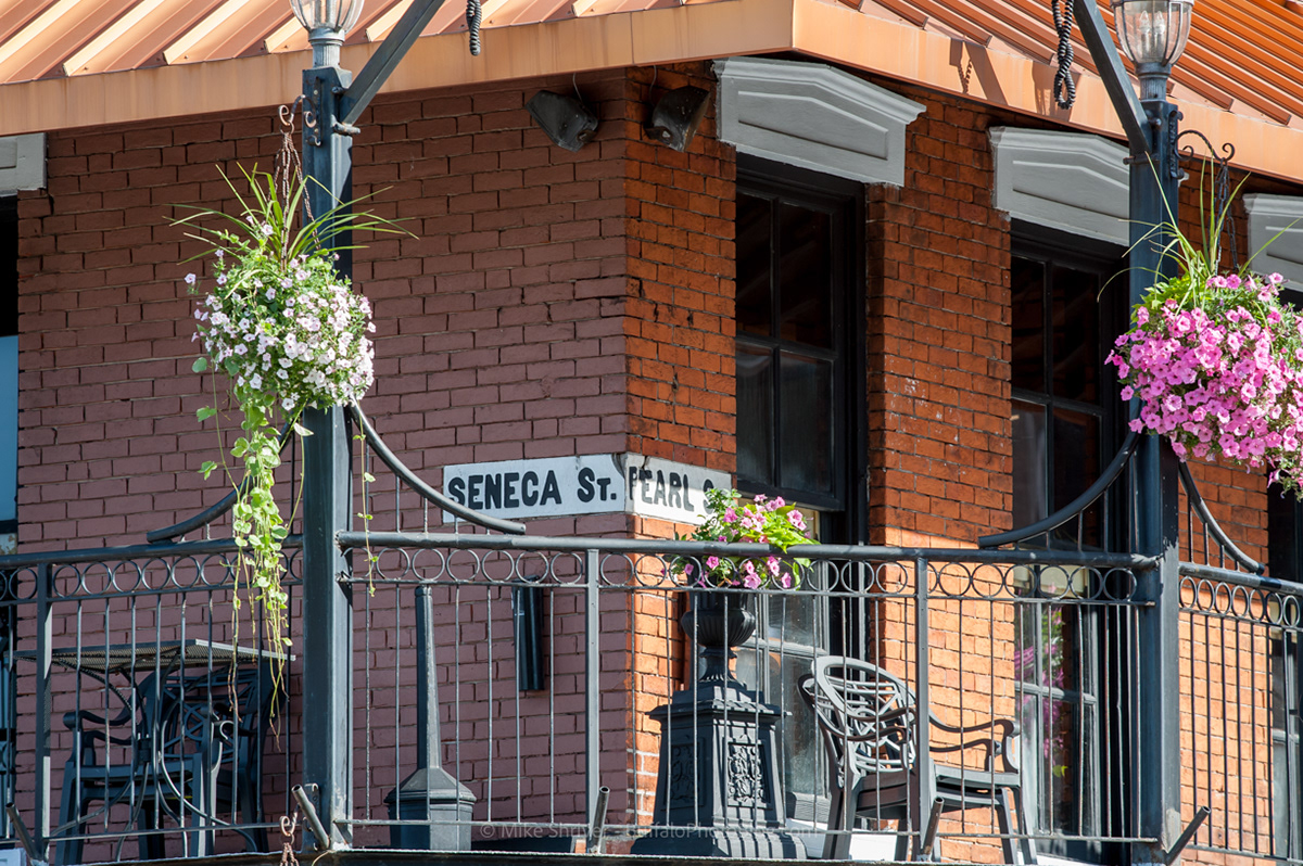
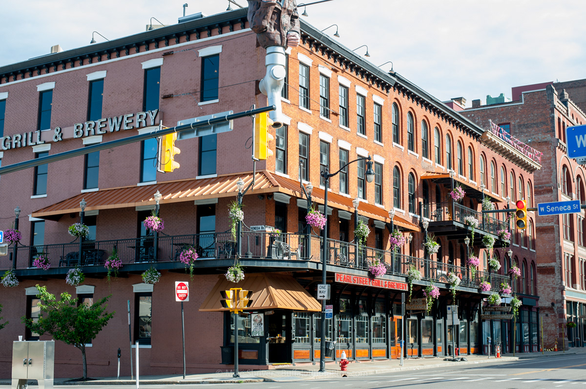
Seneca and Pearl Streets. Second floor of Pearl Street Brewery's balcony.
I could go for an Oatmeal Stout right about now.....
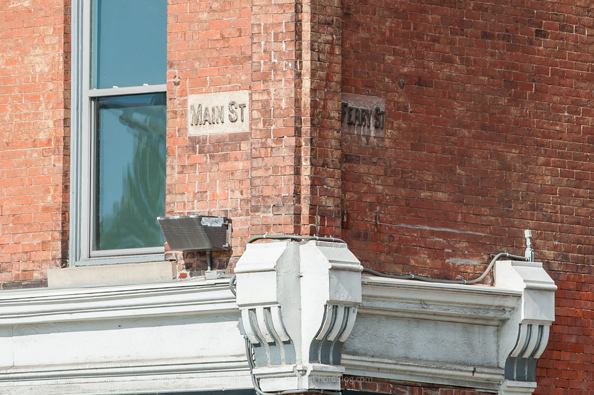
Main and Ferry Streets
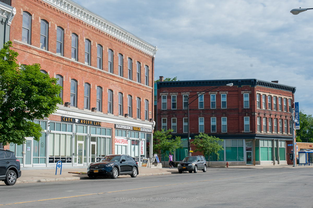
Full scale of the previous image of Main and Ferry Streets
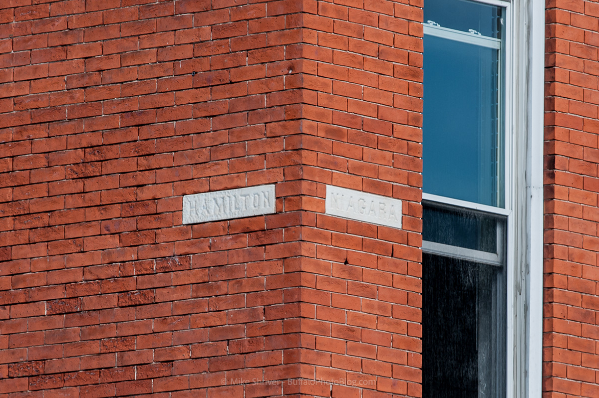
Niagara and Hamilton, Black Rock neighborhood
Full scale of previous image, Niagara and Hamilton along Buffalo's West Side.
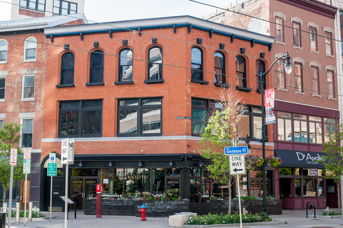
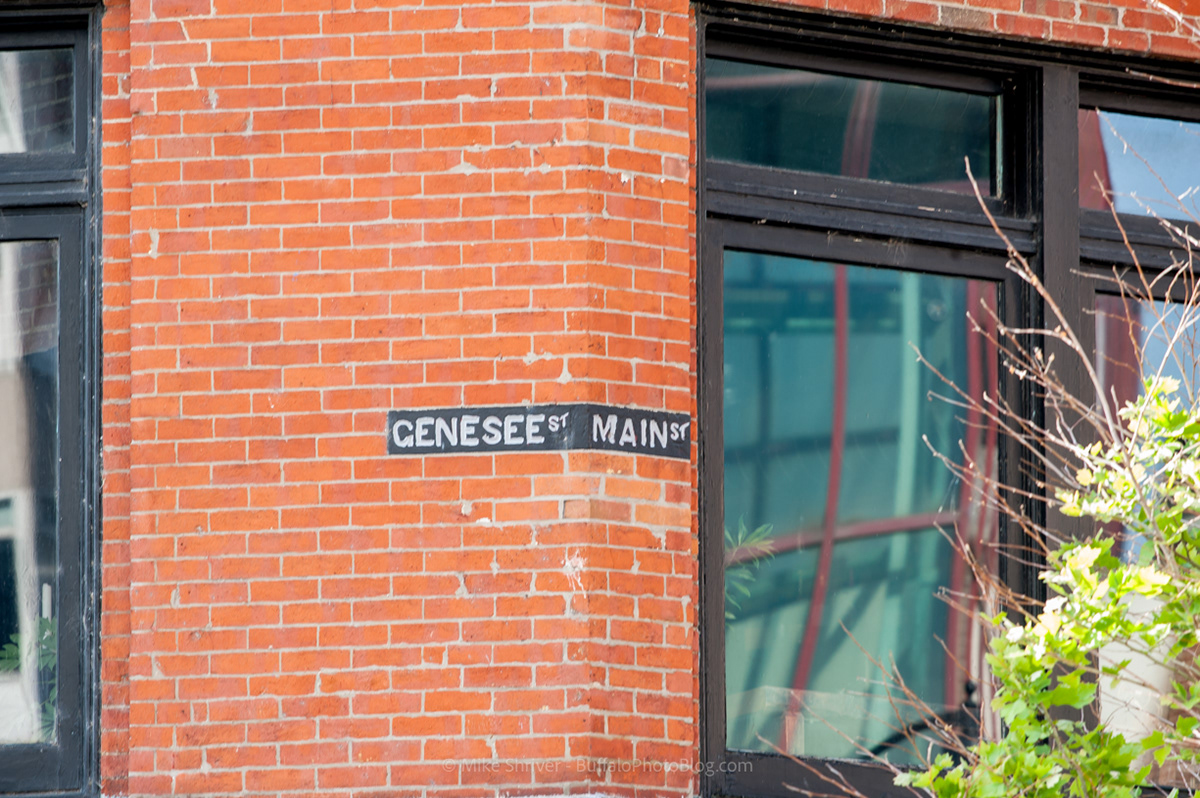
Full scale of the lead image, corner of Main and Genesee Street near Roosevelt Square.